Showing posts with label Norway 8. Show all posts

Norway - Rjukan–Notodden Industrial Heritage Site

"Located in a dramatic landscape of mountains, waterfalls and river valleys, the site comprises hydroelectric power plants, transmission lines, factories, transport systems and towns. The complex was established by the Norsk-Hydro Company to manufacture artificial fertilizer from nitrogen in the air. It was built to meet the Western world’s growing demand for agricultural production in the early 20th century. The company towns of Rjukan and Notodden show workers’ accommodation and social institutions linked by rail and ferry to ports where the fertilizer was loaded. The Rjukan-Notodden site manifests an exceptional combination of industrial assets and themes associated to the natural landscape. It stands out as an example of a new global industry in the early 20th century."

Source: UNESCO World Heritage


Postcard 1 - Rjukan
Rjukan - Vemork kraftstasjon. Thanks to Joey of Norway.


Postcard 2 - Notodden
Tinfos, the "Tin Waterfall" in Notodden. Thanks to Doris who visited Nottoden, Norway. Postmarked March 2020.


Norway - Rock Art of Alta

"This group of petroglyphs in the Alta Fjord, near the Arctic Circle, bears the traces of a settlement dating from c. 4200 to 500 B.C. The thousands of paintings and engravings add to our understanding of the environment and human activities on the fringes of the Far North in prehistoric times." 

Source: UNESCO World Heritage

Postcard 1
Rock carvings showing catching of reindeer and hunting of bear.


Postcard 2
Midnight sun view at Alta musesum with world's longest summer opening hours and the UNESCO World Heritage rock carvings.

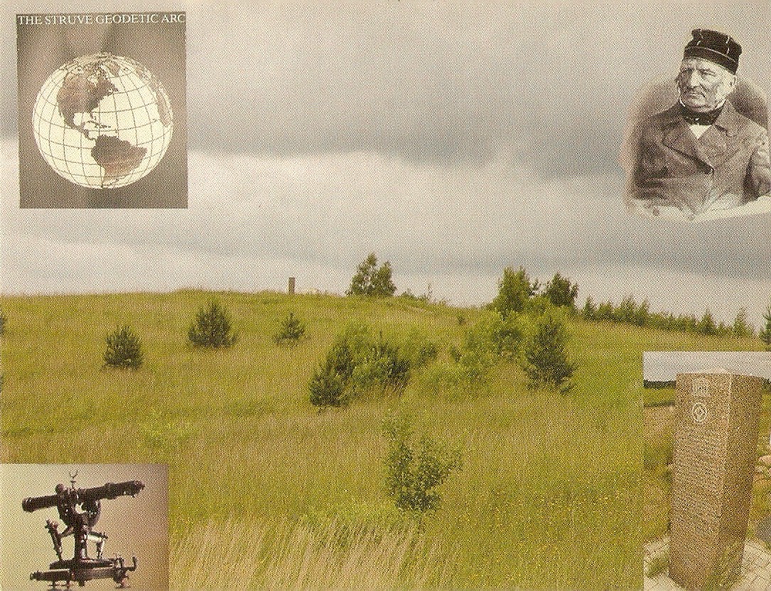
Belarus, Estonia, Finland, Latvia, Lithuania, Moldova, Norway, Russia, Sweden, Ukraine - Struve Geodetic Arc

"The Struve Arc is a chain of survey triangulations stretching from Hammerfest in Norway to the Black Sea, through 10 countries and over 2,820 km. These are points of a survey, carried out between 1816 and 1855 by the astronomer Friedrich Georg Wilhelm Struve, which represented the first accurate measuring of a long segment of a meridian. This helped to establish the exact size and shape of the planet and marked an important step in the development of earth sciences and topographic mapping. It is an extraordinary example of scientific collaboration among scientists from different countries, and of collaboration between monarchs for a scientific cause. The original arc consisted of 258 main triangles with 265 main station points. The listed site includes 34 of the original station points, with different markings, i.e. a drilled hole in rock, iron cross, cairns, or built obelisks." 

Source: UNESCO World Heritage

WANTED: I am looking for Latvia Struve Geodetic Arc postcard - anyone can help? Thanks.

Postcard 1 - SWEDEN
A multi-view postcard showing all of Sweden UNESCO World Heritage including Struve Geodetic Arc in the bottom middle picture. Thanks to Jeanette of Finland. Will be great to get a single view postcard in the future.


Postcard 2 - NORWAY - Hammerfest
Fuglenes, Hammerfest (1187-001) Struve Geodetic Arc  in Finnmark, Norway with aurora borealis in the sky. Thanks to Joey of Norway.


Postcard 3 - RUSSIA - Gogland Island
Hogland (1187-016), Z Gogland, Tochka Z, Kingisepp, Leningrad Oblast in Russia. A Russian Struve Geodetic Arc site. Thanks to Galina of Russia.


Postcard 4 - UKRAINE - Staraya Nekrasovka
Staraya Nekrasovka or Staro-Nekrassowka (1187-034), Odessa Region in Ukraine. Nice stamps of lighthouse used. Thanks to Veronika of Ukraine.


Postcard 5 - LITHUANIA
Struve Geodetic Arc of Lithuania. Thanks to Niina of Finland.


Postcard 6A - FINLAND - Oravivuori
Puolakka Oravivuori (1187-012) Korpilahti, Länsi-Suomen lääni in Finland. View of Oravivuori of Finland with commemorative stamp of Struve Geodetic Arc. Thanks to Heidi of Finland.


Postcard 6B - FINLAND - Alatornion Kirkko Church
Tornea Alatornion kirkko (1187-011) of Tornio, Lapin lääni, Finland. Struve Geodetic Arc goes through 10 European countries with 6 stations in Finland. This station of Alatornion Kirkko Church is one of them. View of the location of the church overlooking the river into Sweden. Nice stamps. Thanks to Sini of Finland.


Postcard 6C - FINLAND - Aavasaksa
Aavasaksa 66.23.52N, 23.12.31E, Finland with Struve Geodetic Arc map in Finland. Thanks to Dubbis of Finland.


Postcard 7A - ESTONIA - Stamp sheet showing map of Struve Geodetic Arc
Postcard of Tallinn, Estonia with stamp showing the map of Struve Geodetic Arc. Thanks to Heidi of Estonia.


Postcard 7B - ESTONIA
Dorpat Tartu Observatory (1187-019) View of Tartu Observatory. Nice stamps used. Thanks to Elina of Estonia.


Postcard 8A - BELARUS
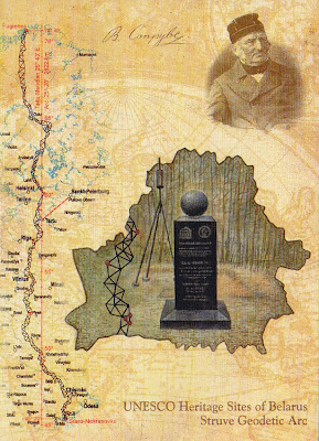
Struve Geodetic Ac in Belarus. Thanks to Byasanich of Belarus.


Postcard 8B - BELARUS
Same postcard of Belarus. Thanks to Anna of Minsk, Belarus.


Postcard 9 - MOLDOVA
Punctul Geodezic Rudi is the only UNESCO World Heritage site of Moldova. Thanks to Katerina of Moldova.


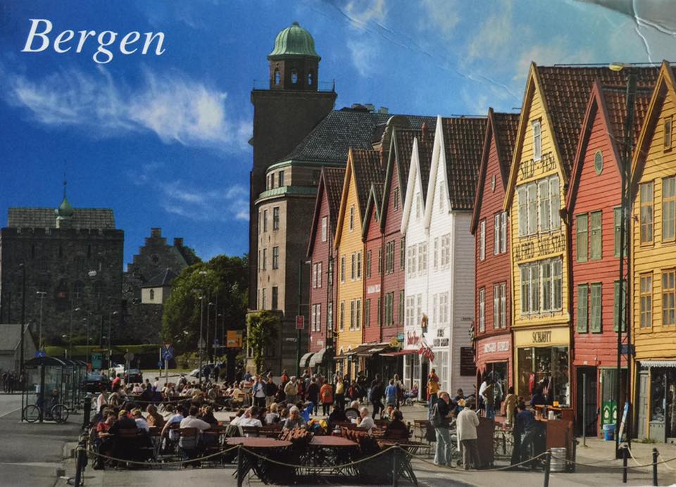
Norway - Bryggen

"Bryggen, the old wharf of Bergen, is a reminder of the town’s importance as part of the Hanseatic League’s trading empire from the 14th to the mid-16th century. Many fires, the last in 1955, have ravaged the characteristic wooden houses of Bryggen. Its rebuilding has traditionally followed old patterns and methods, thus leaving its main structure preserved, which is a relic of an ancient wooden urban structure once common in Northern Europe. Today, some 62 buildings remain of this former townscape." 

Source: UNESCO World Heritage

Postcard  1
Bryggen - BergenThanks HH of Japan for sending this postcard.


Postcard 2 
Pictureque streets of Bergen, Norway. Thanks to Mette of Bergen.


Postcard 3
Nice view of Bergen. Received in May 2016. Thanks.


Postcard 4 
Bergen. Thanks to Melanie of Oslo, Norway.


Norway - West Norwegian Fjords – Geirangerfjord and Nærøyfjord

"Situated in south-western Norway, north-east of Bergen, Geirangerfjord and Nærøyfjord, set 120 km from one another, are part of the west Norwegian fjord landscape, which stretches from Stavanger in the south to Andalsnes, 500 km to the north-east. The two fjords, among the world’s longest and deepest, are considered as archetypical fjord landscapes and among the most scenically outstanding anywhere. Their exceptional natural beauty is derived from their narrow and steep-sided crystalline rock walls that rise up to 1,400 m from the Norwegian Sea and extend 500 m below sea level. The sheer walls of the fjords have numerous waterfalls while free-flowing rivers cross their deciduous and coniferous forests to glacial lakes, glaciers and rugged mountains. The landscape features a range of supporting natural phenomena, both terrestrial and marine, such as submarine moraines and marine mammals." Source: UNESCO World Heritage

Postcard 1 - Nærøyfjord 
Norge: Naeroyfjorden, Sogn. Thanks to Michael of South Africa who visited Norway.


Postcard 2A - Geriaranger
Geiranger Fjord of Norway. Thanks to Inger of Norway.


Postcard 2B - Gerirangerfjord
A panaromic view of Geiranger, Norway. It is part of West Norwegian Fjords listed as UNESCO World Heritage Site. Thanks to Michael of South Africa for sending this card from Norway.


Postcard 2C - Geirangerfjord
Seven Sisters Waterfalls, An awesome waterfall postcard. Thanks to Cathrine of Norway.